


Tuesday, March 4, 2025–6:30 p.m.
-National Weather Service-
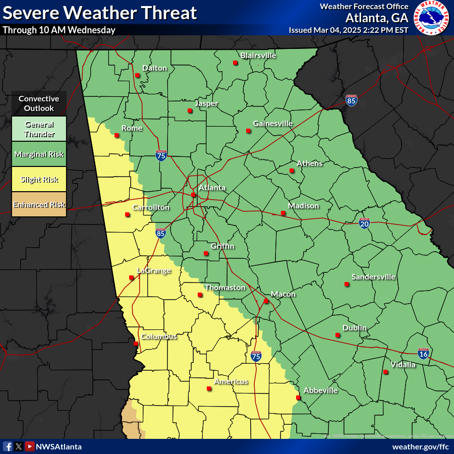
A line of thunderstorms will move through Georgia tonight through Wednesday morning. The thunderstorms may produce damaging winds and a couple brief tornadoes. Strong southerly winds will occur before the storms arrive, and this could result in isolated wind damage as well. The severe threat will conclude on Wednesday morning, but gusty westerly winds will stick around all day on Wednesday, potentially impacting any cleanup crews.
WHAT:
· The primary hazard with any thunderstorms will be damaging wind gusts around 60 mph.
· A couple of brief tornadoes could also occur.
· Wind Advisory through Wednesday afternoon (peak gusts 35 to 45 mph).
· High Wind Warning for the north Georgia mountains tonight (peak gusts 45 to 55 mph).
· We do not anticipate a flooding threat with this event.
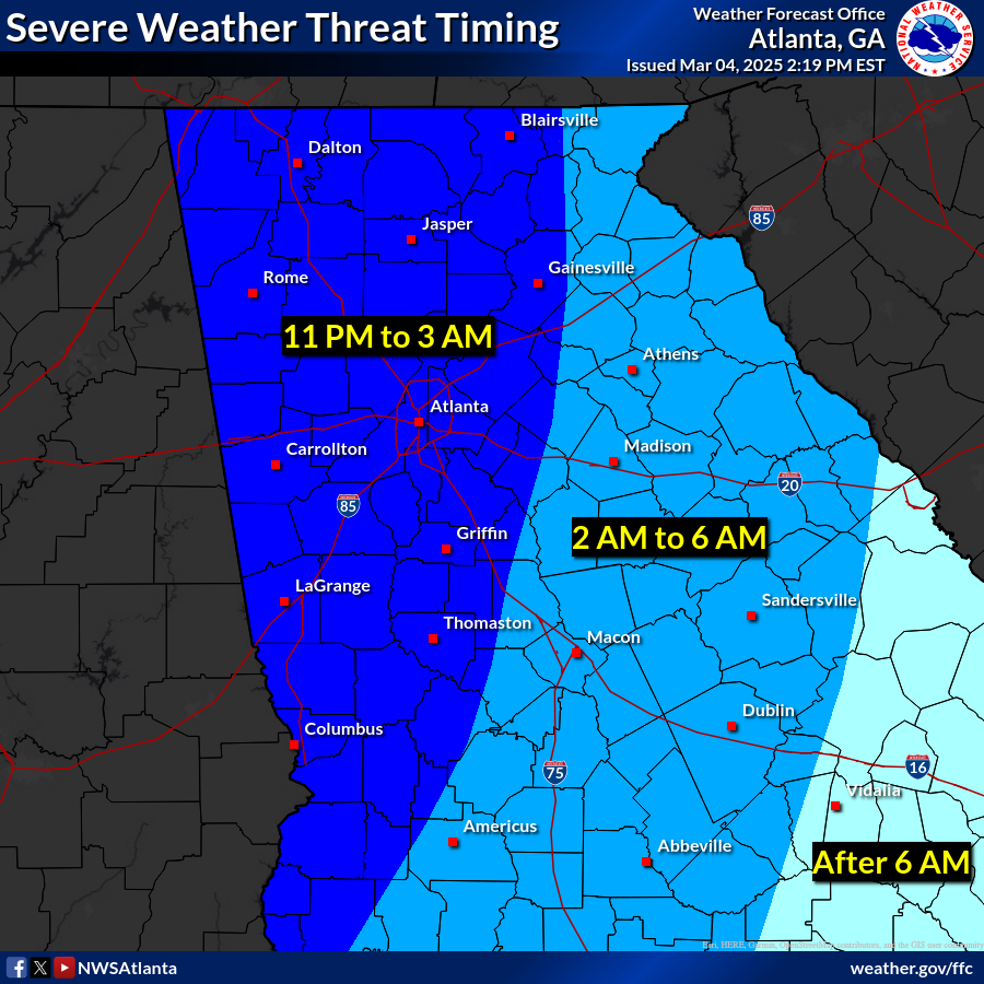
WHERE & WHEN:
· All of north and central Georgia.
· Storms will reach west Georgia between 11 PM and 2 AM, then move east overnight. By 10 AM Wednesday the severe risk will end. **see timing graphic below for details**
· Strong southerly winds will occur before the storms arrive tonight, then gusty westerly winds will develop on Wednesday.
IMPACTS:
· Tree, powerline, and minor structural damage due to thunderstorm winds.
· Isolated tree or powerline damage due to the strong southerly winds ahead of the thunderstorms.
· Gusty westerly winds will impact any cleanup operations on Wednesday.
FORECAST CONFIDENCE:
· HIGH confidence in the thunderstorm timing and intensity.
· LOW confidence in the tornado threat.
· HIGH confidence in the continuation of gusty winds on Wednesday.